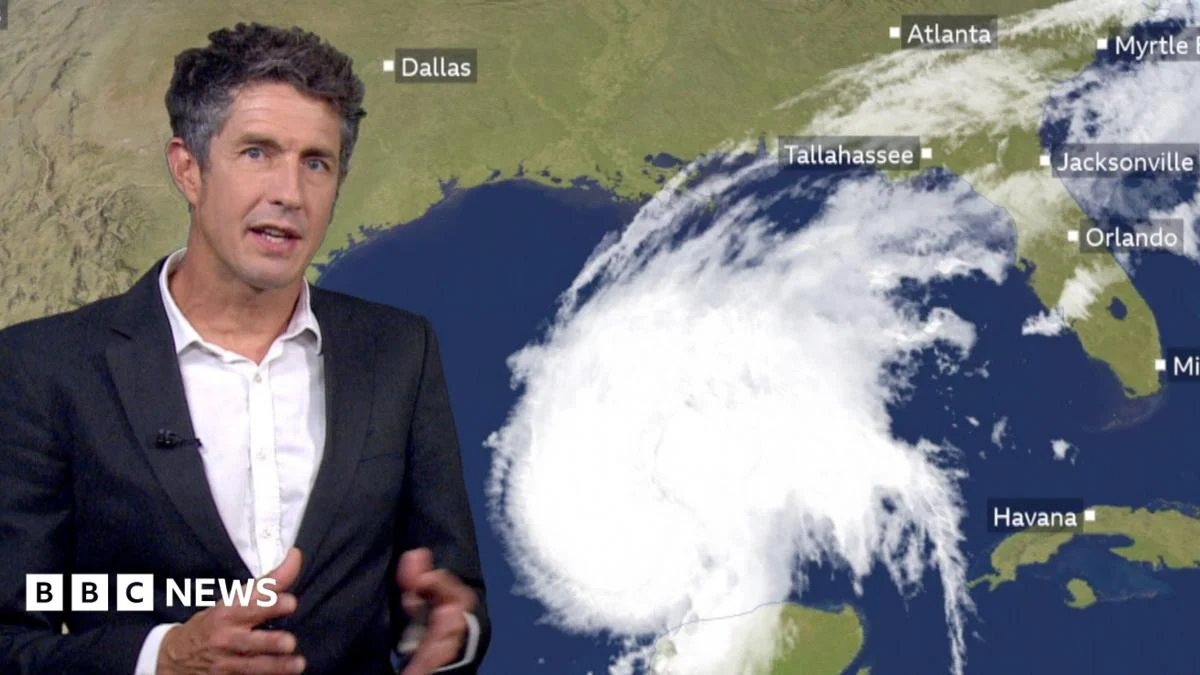
Lede: Hurricane Isaias, the first hurricane of the 2026 Atlantic season, is forecast to make landfall along the Gulf Coast, according to BBC Weather. The system is expected to bring dangerous winds, storm surge, and heavy rains to the region, prompting alerts and preparations among coastal communities.
Key Facts:
– Hurricane Isaias is the first hurricane of the 2026 Atlantic season.
– BBC Weather’s Chris Fawkes says the storm could affect the Gulf Coast on Friday.
– The hurricane may bring dangerous winds, storm surge, and heavy rains.
– Impacts are expected upon Gulf Coast landfall.
– Forecasts remain subject to shifts in the storm’s path.
The Story
What happens next?
As Hurricane Isaias moves toward the Gulf Coast, residents and officials are monitoring forecast updates closely. The storm’s trajectory could shift, altering which areas face the strongest winds and worst flooding. Emergency planners often adjust evacuation zones and shelter openings as new model runs emerge, so local guidance may change in the coming hours. The National Hurricane Center issues regular advisories that refine expected landfall timing and intensity, helping coastal states finalize preparations. Communities from Texas to Florida should review emergency plans, secure loose outdoor items, and stock supplies while watching official sources for updates. Forecasters caution that even small deviations in the projected track can mean the difference between a glancing blow and a direct hit for any given locality.
Who is affected?
The Gulf Coast region spans parts of Texas, Louisiana, Mississippi, Alabama, and Florida, all of which could experience effects from Hurricane Isaias. Coastal parishes and counties are most at risk from storm surge, which can inundate low-lying roads and neighborhoods well before the eyewall arrives. Inland areas may face flooding from torrential rainfall, particularly where drainage systems are already strained. Tourists and seasonal residents in beachfront communities often find themselves scrambling for last-minute lodging if evacuation orders are issued. Schools and government offices might close temporarily, disrupting daily routines for students, parents, and workers. Utilities are pre-positioning crews to restore power quickly after outages, which frequently follow hurricanes of this strength.
How did we get here?
Hurricane Isaias developed out of a tropical wave in the Atlantic, strengthening into the season’s first hurricane amid warm ocean temperatures that fuel storm intensification. The Intertropical Convergence Zone, a band of thunderstorms near the equator, often spawns such disturbances during peak hurricane months. As the system moved westward across the Caribbean Sea, forecasters tracked its evolution through satellite imagery and reconnaissance flights. The name “Isaias” was selected by the World Meteorological Organization for rotational use in the Atlantic basin. Once a disturbance achieves sustained winds of 74 mph or higher, the entity earns hurricane status, triggering heightened alert protocols nationwide. The seasonal naming list rotates biennially unless retired due to significant impact.
What We Know — and What We Don’
Verified by the source:
- Hurricane Isaias is classified as the first hurricane of the 2026 Atlantic season.
- BBC Weather meteorologist Chris Fawkes provided the forecast summary.
- Potential impacts include dangerous winds, storm surge, and heavy rains.
- The Gulf Coast is the projected U.S. landfall zone.
- Impacts are anticipated to occur on Friday.
Still unconfirmed:
- Exact landfall location within the Gulf Coast.
- Peak wind speeds expected at landfall.
- Total rainfall accumulations in affected areas.
- Official evacuation orders or shelter activations.
Why It Matters: Hurricanes pose serious risks to life, property, and infrastructure, especially along densely populated coastlines. Hurricane Isaias threatens to disrupt travel, commerce, and essential services just as many regions continue recovering from prior weather events. Understanding forecasted hazards helps individuals make informed decisions about sheltering in place or evacuating early, reducing strain on emergency responders during the crisis.
What To Watch: Updates from the National Hurricane Center and local emergency management offices will clarify the storm’s track, timing, and potential evacuations over the next several days.